Friday, July 18, 2014

From the Devil's Tower to the Bighorn Mountains

Start: Devils Tower, Wyoming
End: GreyBull, Wyoming
Distance: 303 miles (485 KM)
Gas: Moorcroft, South Dakota 3.655 GAL @ $3.399 TOTAL $12.42; Buffalo, South Dakota, 2.620 gal @ 3.689 Total $9.67

Campsite: KOA Campground, GreyBull, Wyoming
Cost $38.42 per site; a very well kept KOA campground located just west of the Big Horn Mountain range. Very clean and modern facilities; nice hot showers, laundry, hydro & water and restaurant with otdoor cafe. The lot was large with nice grass and very quiet.

We got up early, showered, had breakfast and then headed for the Devils Tower. There is a $5.00 fee for motorcycles to enter the park. We were awed by the size of the lava dome when we were up close. There is a small trail to follow around the tower. As we walked and took photos, we read bits of info placed along the path. It appears that the earth around the lava dome eroded away for a depth of almost 1.5 miles, leaving just the lava dome exposed. There is also a rim of very red rock surrounding the dome. The dome is about 850 feet high.


As we circled the dome, we saw perigrene falcons. Further around the dome, we saw a couple of guys climbing the tower. It was a slow but methodical climb and we watched them for quite some time. Moving a bit further, we saw an old wooden ladder that was used about 100 years ago by the first person to climb the dome.
Right next to this ladder, we saw a girl, climbing by herself, even higher than the 2 guys we were watching. They just looked like little specs up there. A ranger said that about 5000 people climb the tower each year. We could have watched them for hours, but we had to be out of the park by 11:00, so we backtracked the path and started to leave the park. There were hourdes of people now coming into the park, so it was a good time to leave.


Heading back, we enjoyed the route back to the interstate and then we west again.
As we headed west, the terrain became semi-arrid with expansive fields of grass and sage grass. There were few trees and the horizon was nothing but brown grasslands with dashes of green from the sage bushes.The area is so large, the speed limit in the area is 80 mph. That works out to 129 km/hr. As we are used to 0 mph, it took a while to get our speed up to the 80mph and go with the flow of traffic.
We filled our tanks in Moocroft, a very tiny turnoff, as we did not want to get stuck in the middle of no-man;s land.
We rode thru Keystome and saw what looked like a huge tar sands pit.
We rode thru Gillette, Wyoming, which is a very large town in Wyoming.
From there, we crossed the huge barren grasslands and noticed how arid the area was.
As we neared Buffalo, Wyoming, we could see the outline of the mountains. I checked the temperature on my bike and we were hitting the 90's. That explained why the mountains were grayed out from a haze.
We gassed up, updated the blog from yesterday,did a bit of grocery shopping, and then headed north on the intersate 90 so we could take a scenic route 14 thru the mountains towards  Yellowstone.
We went north to Sheridan and then took Hwy 14 West towards Greybull, which is on the other side of the Bighorn Mountains.
We weaved thru roads coming up to the haze covered mountains and were a bit disappointed because the scenery was magnificent behind the haze. We could'nt take any decent photos because of that. The temperature was hot, over 90 degrees at the base.
Once we started climbing the Bighorn Mountains from the east, we climbed and climbed on switchbacks and it seemed you were right against the edge. It's hard to admire the scenery and keep your eye on the road at the same time.


We stopped a few times for photos, but again, disappointment because of the haze.
Once at the top, we rode for miles along rolling treed hills with lush grass.

After about 1/2 hour, we started down the otherside and the veiws we even more spectacular.  Instead of a forested mountain, the west side is massive mountains of granite, dating back about 500 million years. They were massive and when we started down, we could not stop to take photos as the road was sweeping back and forth and there were no turnoffs to stop for photos. Such incredible beauty that we could not capture on photos. The size of the cliffs and the canyon walls are indescribable.
We were able to stop at one scenic resting point to photo Bald Mountain which has an elevation of over 10,000 ft (almost 2 miles above sea level). There is a small river running thru the bottom of the gorge which had some nice cascading waterfalls.
As we proceded thru the mountain pass, the rock formations changed colours from browns to whites to bright red. The rock cuts were dynamic and the curves sweeping back and forth as we could see the route we would be soon travelling on, way below us.
It was getting a bit late and it looked like rain, so we had to hurry out of the mountains. It was a bit sad to leave such a gorgeous location.


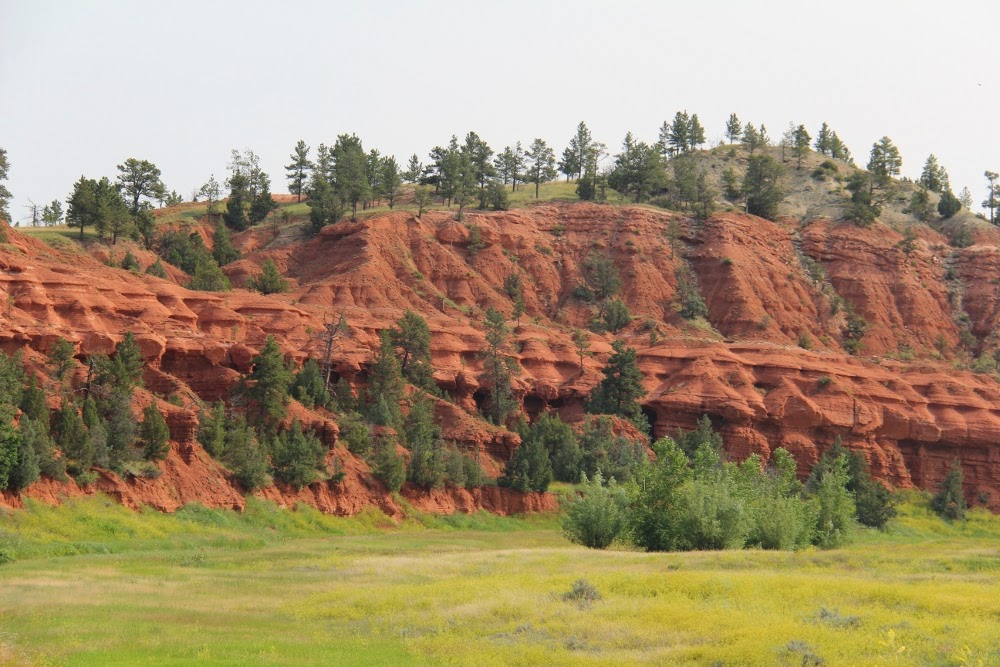
Once out of the mountains, the terrain became rolling and there were bluffs of very bright red and crimsom shooting out of the grasslands.
We rode about 45 minutes and stopped at the KOA Campground int Greybull. It is the cleanest campground ever recorded. You could eat off The washroom floors, the showers were spotless and the outside eating area is very charming. When we arrived, Maria and Cor, the owners, greeted us with a bottle of cold water. It was such a nice touch.


We bbq'd a nice dinner of cube steak, mixed vegetables and eggs, topped with a glass of wine.
When I started the blog, the bugs came out and were so bad, we had to call it a night.
We are now on our way to Yellowstone National Park. In talking with others, the park is rustic so there is no electricity, wifi, showers, flush toilets, etc. It will be a refreshing day without technology and many conveniences we take for granted!

Thursday, July 17, 2014

Yesterday...bad wifi makes it hard to blog


Start: Rapid City, South Dakota
End: Devils Tower, Wyoming
Distance: 197 miles (315 KM)
Gas: Keystone, South Dakota 3.721 GAL @ $3.850 TOTAL $14.33; Spearfish, South Dakota, 2.423 gal @ 3.579 Total $8.67

Campsite: KOA Campground, Devils Tower, Wyoming
Cost $41.51 per site; a small KOA campground located at the base of Devils Tower. Nice facilities; nice hot showers, laundry, hydro & water and restaurant. The lot was treed and quiet. They play the movie Close Encunters each night as that's where part of it was filmed.

We got up early, did laundry and took advantage of the all-you-can-eat pancakes held by the KOA. When we were ready to leave,my bike would not start as the battery was dead. I must have left it on too long, without it running and with my trailer still hooked up, so the lights of the bike and trailer drained the battery. A camper had booster cables, so we were able to get it going quickly. We then drove to a Mennards and bought a cheap set of cables to keep on the bike...just in case.

We then went down Hwy 16 to Keystone so we could visit to Mount Rushmore. Keystone is a quaint little town that is bustling with souvenirs and little eating spots. We stopped for some gas and then headed towards Mount Rushmore. 


It was a nice scenic ride to the park. We paid $11 parking and then walked up to the viewing area for the carvings.

The carvings were very impressive. The detail and the smoothness of the faces was amazing. The faces of George Washington, Theodore Roosevelt, Thomas Jefferson and Abraham Lincoln looked almost lifelike.
Interestingly, 90% of the rock was removed from the mountain by using dynamite and then airpowered chisels smoothed out the features. It took from 1927 to 1941 to complete the carvings.


From Mount Rushmore, we took a small road thru the Black Mountains as we headed towards Deadwood and Spearfish. The road was well paved, very windy and seemed to cross a railway line at least 20 times as it weaved thru the mountains and forests.

We got onto Hwy 35 and headed north to Deadwood. The road was very windy and went thru the beautiful Black Hills. Once we got to Deadwood, we were not really impressed too much. This was a town that had historical connections to Calamity Jane, Buffalo Bill, Jesse James and others. The town had a beautiful cobble stone town centre, but the rest was too modern and busy. 


We decided to head toward Devils Tower by taking Hwy 14 thru the Spearfish Canyon. This was an amazing ride as we went up and down very high hills and deep valleys as we went thru the canyon. At one point, we went down a 7 degree hill for 2.5 miles and another time we went down a 7 degree hill for 3 miles. Needless to say, we went in low gear and let the engine to a lot of the braking.

As we weaved thru the Spearfish Canyon, we saw a lot of fly fishermen, tossing their lines in the little river that ran thru the canyon. It is hard to describe how high and rocky the face of the canyon went as we rode thru.

Once we got to Spearfish, we were officially out of the Black Mountains and then headed west towards Wyoming. Wyoming is very hilly with a lot of cattle. There are a lot of buttes, hills and valleys. I didn't see one lake. This is real cowboy country.


We went down the Interstate 90 and cut off at Sundance and headed for the Devils Tower.
The ride was very nice, going thru the rolling hills. The rock face cuts along the valleys are a bright red due to the high iron content in the soil.
As we approached Devils Tower, you could see it from quite a distance. Legend has it that a bear was attacking 8 girls and the girls started praying to save them, so the rock shot up towards the sky and that's how the Big Dipper constellation was formed, each star being a girl. The large strokes lining the tower were said to be the claws of the bear trying to snag the girls. 

The modern version has the tower being the dome of a volcano and over the millenium, the rock and debris around it eroded downward 1.5 miles from it's original top, leaving just the cooled lava dome exposed. 
We got here late, so will need to take some good photos tomorrow.
The tower was a highlight of the movie Close Encounters...out of this world!


Wednesday, July 16, 2014

South Dakota and the Badlands

Start: Adrian, Minnesota
End: Rapid City, South Dakota
Distance: 425 miles (680 KM)
Gas: Mitchell, South Dakota 4.301 gal @ $3.559: TOTAL $15.33; Kennebec, South Dakota, 2.869 gal @ 3.659 Total $10.50; Cactus Flats,South Dakota 3.14 gal @ $3.984 Total $12.53;

Campsite: KOA Campground, Rapid City, South Dakota
Cost $45 per site; a small KOA campground with very nice facilities; nice showers, laundry, game room, heated pool, hydro & water. The lot was the size of a dime and had no trees, just a small place to set up and a nice picnic table with a shade covering. Expensive, but quiet.

We started off from Adrian quite early as we knew we had a long ride ahead of us. We were only 25 miles from the Minnesota/South Dakota border, so were anxious to ride down the Interstate 90 to get into South Dakota. While the speed limit on the Interstate 90 is 75mph, we only rolled along at 65-70mph.
Western Minnesota was not what I had expected at all. I always thought of Minnesota as a land of 1000's of lakes and thick forest. Travelling thru south western Minnesota was like you were going thru Saskatchewan. Large plains as far as you can see, with very few trees. There was a shift from the corn fields to more cattle and hay.
Once we got into South Dakota, the landscape started with rolling dells and treeless hay fields and later turned into incredibly large plains, as far as you can see. There were a fields of hay bundles and many herds of grazing cows. The landscape seemed to go on forever and you would swear you could see the curvature of the earth, so expansive were the plains. Nothing but grasslands as far as you could see, in all directions. It was an amazing sight. I kind of chuckled because we were given information about taking scenic route 16 across the plains, but the interstate had exactly the same scenery...grasslands going on forever. Scenic 16 would have been a slower road, but not difference in landscape.


When we arrived at Chamberlain, South Dakota, we crossed the Missouri River. It too was stunning, but we could not take photos as we came across a hill top, started down a large hill and there was the Missouri. We had no place to pull over. Once again, like the Mississippi, it was breathtaking to see (but no proof in photos). We also came across some large lakes that seemed so out of place. Later I found out that they had damed the Missouri River to create 4 large lakes that they call the Great Lakes...no wonder our water levels are getting low!
About 100 miles from Rapid City, we decided to detour through the Badlands National Park. It cost $10 to ride through the park, but it was worth every cent. Even before entering the park, we were blown away by the huge outcroppings of barren rock structures. The land structures, made of peaks, buttes and gullies were everywhere and seemed to change colours as the sun came out or as we turned a corner. There were many little turn-offs where we were able to stop and take some great photos. There were a lot of paths that you could take if you wanted to climb some of the peaks or into some of the buttes. It really reminded me of the old west movies. Once we started heading out, there were more awesome views, at different angles. The badlands seemed to go on forever and we finally climbed a very large windy road on our way out of the park. This is definitely a place to visit!


Once we left the park, we rode down the 90 to Rapid City and set up our tents in the KOA in Rapid City.
Tomorrow, we plan on going to Mount Rushmore which has the sculpted heads of 4 U.S. presidents. We will also tour some of the other sites in the area.
It was a great day and we look forward to more days like this.