Thursday, July 24, 2014

The End of the Road-Back in the Sault

Start: Marinette, Wisconsin
End: Sault Ste. Marie, Ontario
Distance: 282 miles (451 KM)
Gas: Marinette, Wisconsin: 2.778 gal @ 3.599 Total $10.00; Manistique, Michigan: 3.816 gal @ 3.659 Total $13.96;  Sault Ste. Marie, Michigan: 4.262 gal @ $3.739 Total $15.94

Campsite: Al & Donna's Superior View on St. Mary's River, Sault Ste. Marie
Al finally got to sleep in his own bed after 13 days away. I enjoyed the comfort of their nice, rustic bunkie that was very comfortable and all the conveniences I could ask for: a cozy warm bed, coffee, wifi, tranquility!


We had a nice, relaxing ride to the Sault, knowing we would be there in a few hours and wouldn't have to push to the next destination.

The ride was uneventful except for a short period of time when I lost sight of Al. I always sporadically checked my rear-view mirror to ensure we were riding together and things were going smoothly, but this time, Al was nowhere in sight. I pulled over for a bit and still no Al. After a bit of time, I turned around thinking there might be a problem.  There was! My camper trailer spare tire had fallen off in front of Al while riding down Hwy 2. He was a distance behind me, so was able to stay clear of the tire. He had stopped to retrieve it for me as I had no idea what had happened. I think the very bumpy Highway 41 in Green Bay coupled with the strong gusts of side winds, rattled the tire enough to loosen the bolts that held it in place. Thankfully  nothing happened from the event and Al was able to recover the wheel. If it had happened in the Green Bay construction chaos, my wheel would have been forever absorbed in the construction vortex.

We continued to Manistique and stopped at the cute lighthouse and boardwalk. We met a couple that were travelling to Iron Mountain on their Harley, to surprise their kid for his birthday.


Later down Hwy 2, we stopped at the Tower (where we viewed Mackinaw Bridge at the start of the trip) and bought a few things.

We continued down the I75 from St. Ignace, having to take a slight construction detour, and got to the International Bridge. I went thru customs without incident, but Al, because he was not riding a Goldwing, was pulled over and they searched his camper. It was a quick and uneventful search, so we proceeded directly to where my grandmother was so we could visit her right away.
It was nice to see her even though she as sleeping most of the time. She looked very frail. When she did awaken, I was able to get a smile and four kisses from her.

Pushing it hard for 2 days was well worth those little kisses!

A Long Ride Homeward

Start: Chamberlain, South Dakota
End: Marinette, Wisconsin
Distance: 721 miles (1154 KM)
Gas: Chamberlain, South Dakota: 3.309 gal @ 3.659 Total $12.11; Humboldt,South Dakota: 4.172 gal @ 3.319 Total $13.85;  Jackson, Minnesota: 3.465 gal @3.459 Total $11.99; Stewartville, Minnesota: 4.280 gal@ $3.359, Total $14.38; Tomah, Minnesota: 3.140 gal @ $3.599, Total $11.30

Campsite: B&B $49:  We rode for quite a while and wanted to get past Green Bay to avoid the horrendous highway construction, so when we got to Marinette, Wisconsin, we were unable to find a place to camp or stay. The only place available was a B&B that was run by an old widower. Her place was so, so busy with vases, trinkets, crystal, junk. We complmented her on how nice her home was but, with tourquoise toilet and matching sink, thick, thick grass green shag carpet, fancy wallpaper....

We decided again that the priority was to get back to the Sault asap to see Grandma Furkey. The weather had cooled down a bit and we had the wind to our backs as we headed back along Interstate 90 on the same route we took to get out here.

There was not much to mention as we retraced our steps eastward. Instead of hot, semi-desert rolling hills, we were now back in farmlands of Minnesota and Wisconsin.

I had wanted to get a photo of the Mississippi River at Onalaska, but once again, the construction on the Interstate and the bridge over the Mississippi foiled my photographic attemtpts.

When we got near Oshkosh, Wisconsin, close to where we had camped on our way westward, we decided to push more northward to get past the highway construction that was taking place between Appleton and Green Bay. On Highway 41 at Appleton, the highway was extremely bumpy causing the trailer to bounce a a lot. Once we got to Green Bay, the road construction was a chaotic-maze of traffic pilons and the gusts of wind was blowing us all-over. Coupled with the bouncy road surface, it is amazing we made it thru the maze after the sun went down.

Once past Green Bay, we had to ride north another 45 miles so as to find a place to stay. As everything was booked, we were told of a B&B operated by an older widower that had a room. We were kind of desparate for lodging, so we went to the B&B in Marinette. The home was absolutely cluttered with stuff, but the room was clean, very pink and comfortable.

We called it a night knowing we would have a relaxing trip into the Sault the next day.

Tuesday, July 22, 2014

Heading Home: Too Hot for Arches

Start: Rock Springs, Wyoming
End: Chamberlain, Soth Dakota
Distance: 705 miles (1128 KM)
Gas: Rawlings, Wyoming, 2,97 gal @ 3.719 Total $11.05; Casper, Wyoming, 2.912 gal @ 3.949 Total $11.50;  Lusk, Wyoming 2.703 gal @3.899 Total $10.54; Martin, South Dakota 4.683 gal@ $3.899, Total $18.26; Kadoka, South Dakota 1.564gal@ $3.869, Total $6.05

Campsite: Super 8, Chamberlain,South Dakota; $88.25

We were able to refresh by staying in the motel instead of a campsite. We were talking with someone at the motel that said she thought our bikes would be blown over by the high winds that went thru Rock Springs last night. I guess it was a good decision to not rough it.

We had a continental breakfast, finished the blog, packed up  and hit the road. Our goal is to get back to the Sault as quick as we can so we can see Grandma Furkey.

Our plan is to go thru Casper, thru northern Nebraska to get to South Dakota, covering as much territory as we can. We had a quick, smooth trip to Rawlins that was about 105 miles north east of Rock Springs. Once we headed north towards Casper, we were blasted by west winds. We motored along on an angle against the wind for about 45 miles. I had to stop to reset the top of my camper as it was almost blown off.  All along the highway, you can see wooden wind fences to protect the road against gusty winds. I can't imagine how bad the roads would be in the winter. As we were being ravaged by the winds, the terrain in the area was quite different. The arrid landscape had more green vegetation, a few more trees and the rock had a lot of a crimson red colour.


From Casper, we continued east to catch Hwy 21 towards Nebraska. Again, the winds were strong, but once we took the east cutoff, the winds were at our backs and it was smooth riding again. The road was in good condition for us to ride about 70 mph. As soon as we hit the Wyoming/Nebraska border and entered Nebraska, the road turned from good to amazing. The road was so smooth, with no snake tar lines.

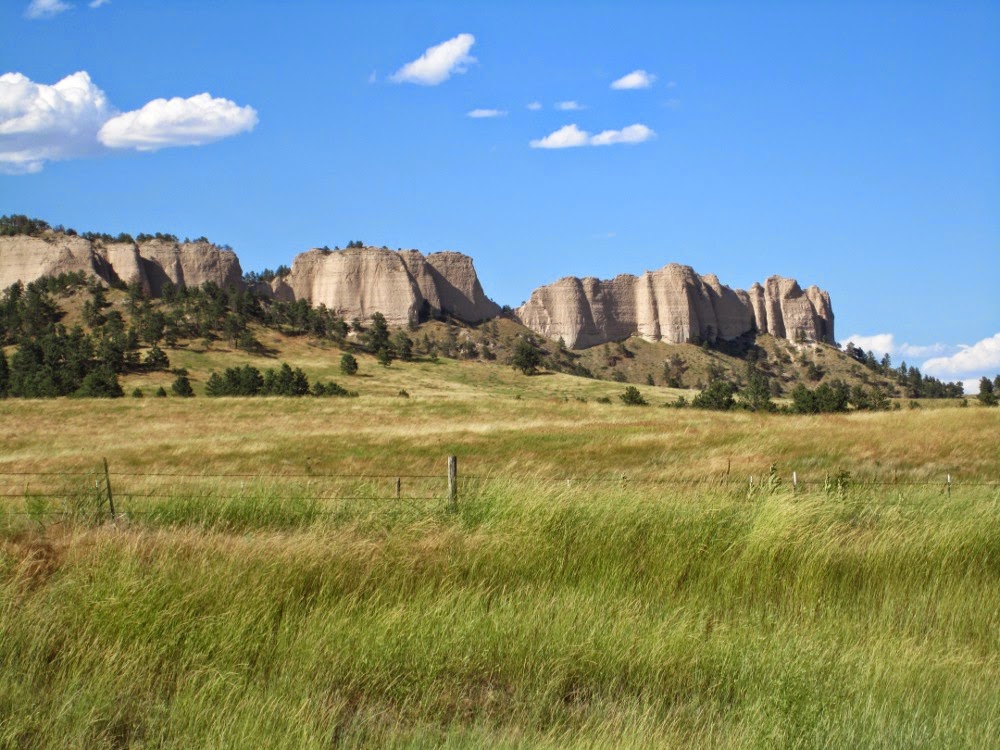
We went thru some typical terrain...flat, dry, expansive but later, we after we went thru Chadron, Nebraska, we saw some very impressive rock formations along the Crazy Horse Highway.


Later, the land became very flat, expansive and hot. I recall seeing a freight train before Mile 167 and it ended at Mile 168. I was surprised that the train would be about 1.25 miles in length. Later, I saw another train that was over 2 miles in length. The landscape is so flat and huge, the trains are able to be incredibly large.

The sky was bright blue with a few bright white clouds. Temperatures started to rise and went from 95 degrees, to 103 degrees. It was blistering. We had to continually drink and drink and drink as it was so damn hot. Ironically, for all of this trip, we have had to wear long sleeve shirts and long pants to protect us from the sun. We had packed a lot of shorts and T-shirts, but can't wear them. I guess this is a good learning experience for our next venture!
We followed the highway to Merriman, Nebraska, where we turned north towards Martin, South Dakota. In Martin, we filled up, ate a bit and then headed north for 58 miles to Kadoka, South Dakota.


It was getting late, but we still wanted to cover more territory, so we decided, from Kodoka, to take the Interstate 90 all the way to Chamberlain. We travelled for 14 hours, over 1100 km, in 100 degree temperatures. We decided to once again stay in a motel so we can be fresh for tomorrow's long ride.

Monday, July 21, 2014

Yellowstone to Rock Springs thru Grand Tetons

Start: Lewis Lake, Yellowstone National Park, Wyoming
End: Rock Springs, Wyoming
Distance: 355 miles (568 KM)
Gas: Jackson, Wyoming, 1.934 gal @ 3.759 Total $7.27; boonies, Wyoming, 2.912 gal @ 3.949 Total $11.50;  Rock Springs, Wyoming 4.348 gal @3.859 Total $16.78

Campsite: Super 8, Rock Springs, Wyoming

We packed up early, knowing we would have along day ahead of us. We headed towards the South Entrance of the park, viewing the Grand Tetons that were in the distance.


Riding down the road, we came to Lewis River Canyon, a deep canyon with the Lewis River running thru it. It's amazing how deep these gorges can get. About 20 years ago, a forest fire was on one side of the canyon and the winds were so strong, that it blew flames right across the canyon, setting the other side of fire as well.


As we got out of the park, the scenery was scenic forests. Further, we started getting closeup views of the snow-patched Grand Teton Mountains. They looked stately in their grandeur. We had to stop numerous times to take photos as they were a bit awe striking.


Further, towards Jackson, Wyoming, we came to a pasture that was full of wild buffalo on one side of the road and the Grand Tetons on the other...what a sight!


As we rolled towards Jackson, I was impressed by the cycling lanes that were quite a distance from the town and the ski hills in the distance. Jackson appears to be quite the resort town, with a real cowboy flavour. As well, there was a huge elk reserve before entering town.

As we got into town, the town centre was bustling with tourists. We found a spot to park and walked around the small town centre. It is quite evident that elk has an importance in this town. There are huge antler horn rack displays all over town.


This is a shoppers haven. All kinds of sporting stores geared to the outdoors-cycling, hiking, watersports.  There were many leather shops, clothing stores and a wide variety of unique shops with interesting goods. There were no mall type franchise stores...each store was unique and run by locals. There is also a dynamic river rafting business going on as there were all kinds of white water rafting outfits in the area and you could see trucks loaded with rafts driving up and down the highway. The Snake River is a popular water sport river with it's fast flowing current and white rapids.


Make sure you read the price tag because everything is expensive...a nice jacket that Al thought was about $115, was actually $1150. Sorry, Donna...no room to bring it back on the bike!

When we gassed up in Jackson, I talked with a local and he said Arches is extremely hot this time of year and locals only visit the park in the fall when tempoeratures subside a bit. Starting to second guess about going to Arches as we are hot!

We left Jackson and headed towards Bear Lake where we intended to start heading east towards Arches National Park. We stopped to get some fluids as the heat was taking it's toll; but my bike was only reading 82 degrees and the hot dry air was taking it's toll. I recall seeing a sign for the Continetal Divide (separates the watersheds that drain into the Pacific Ocean from  those river systems that drain into the Atlantic Ocean and the elevation was about 7100 feet above sea level. Being about 1.5 miles above sea level, that too, was impacting our hydration.

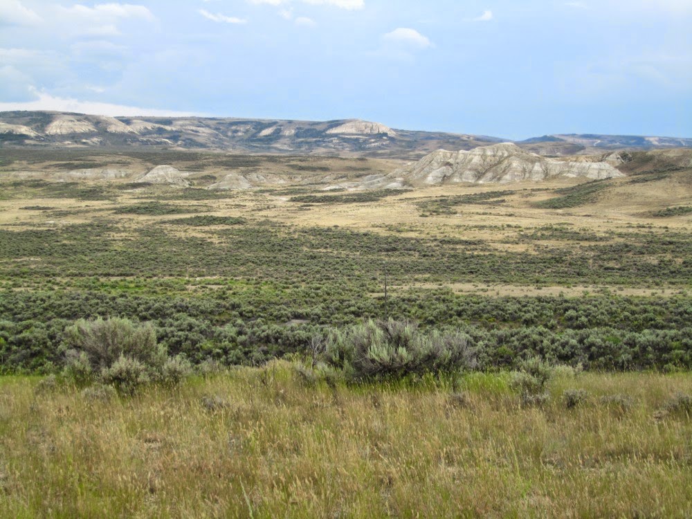
We were riding into the Bear Lake, Montpelier area, we went down some huge grades...3 miles of 7 percent grades. At times it seemed we were going down forever and I couldn't remember climbing so much to have these downgrades. The scenery was typical arrid steep hill covered in short grass and sage. We've seen a lot of that in this area. As we got to Montpelier, we talked with a local motorcyclist from Salt Lake City and he gave us the goods on what to expect in Arches. We are sweltering and he said to add another 20 degrees...he said temperatures are in the 100's. He also said the route would be another 400 miles. That would add a day and a half to our ride.


Al and I decided to go a bit further down the road and decide whether to make the trip to Arches. When we got to a cutoff that would either take us to Dutch John, a small town before heading south to Arches, or take us more east, we decided to put off the Arches trip. We felt that there are other places in the same area as Arches...Zion National Park, Monuments National Park, Grand Canyon. We thought that made more sense. And, I hoped by heading back east, I could get to see Grandma one more time. So, we headed east towards Rock Springs, Wyoming.

Along the way, most of the scenery was steep rolling hills covered with short grass and sage. A bit further, we saw a very dark gray sky with large whisps of rain bands. We questioned whether to wait it out or try to out run it. We recalled trying to outrun the storm in Quebec, where we lost. We decided to outrun it as it was a huge storm. We seemed to get ahead of the storm and all of a sudden, it seemed as though it was closing in on us again. This happened 3 or 4 times. Finally, when Al's bike was running on fumes, we got to Rock Springs, dry!

We decided to take a motel room to freshen up, charge the laptop, Ipods, camera batteries and stay dry. We will be heading back now, deciding on our route in the morning.So, Arches has to wait until Al, Donna and I are retired and will take the trip sometime in the fall of our first year off...nice retirement vacation!

Touring Yellowstone National Park

Start: Lewis Lake, Yellowstone National Park, Wyoming
End: Lewis Lake, Yellowstone National Park, Wyoming... a day of touring
Distance: 181 miles (290 KM)
Gas: Grant Village, Yellowstone National Park, Wyoming, 2.678 gal @ 4.299 Total $11.51; Grant Village, Yellowstone National Park, Wyoming, 3.319 gal @ 4.299 Total $14.27

Campsite: Lewis Lake Campground, Yellowstone National Park

It was a very cool night, but we awoke early to take advantage of travelling before the roads got too busy. Today, we wanted to see the many unique things that Yellowstone had to offer.

After having a breakfast of scrambled eggs, baked beans and coffee, we set out, with Old Faithful being the first stop. We went down the road about 18 miles and just before we got to where Old Faithful was, we saw a puff of steam in the distance. Old Faithful had just blown it's stack, so we would have to wait about an hour and a half before the next eruptions.

We walked along some of the wooden walkways and saw very colourful hot springs of boiling water. The water was crystal clear and you could see far into the little bowls. Some appeared tourquoise blue, but the water was so, so clear. The smell of sulphur was apparent at each spring and geyser. We saw a man just setting next to a steaming geyser as it is thought to be therapeutic.


We saw many sizes and shapes of geysers and hot springs. We were told Old Faithful would spout at 10:25, give or take 10 minutes and it blasted at 10:39...a little late. I saw a sign stating that the ground was just a thin crust and below could be boiling areas. It said that in the past, there have been dozens of people that were scaled to death by venturing off the wooden trails. We saw evidence of a buffalo that was not so fortunate. We could see the bones and head of a boiled bison.


Once we left Old Faithful, we headed towards Madison on the west side of the park. The west side is full of sulphur beds, hot springs and geysers. All along the road, you can see them and smell them.

We stopped at the Midway Geyser Basin. Here, we saw a few small but beautiful hot springs. We walked about a mile and then climbed a huge, steep hill to see the Grand Prismatic. It's the largest hot spring in Yellowstone. The colours were magniicent torquoise with yellow, orange and gold patterns and you could see the steam rising from the surface. Later, we walked a boardwalk to take a closer look and you could see the bubbling steaming hot, crystal clear water, but also the array of colours from the chemicals in the springs.


We continued north between canyon walls, following a nice river that flowed at the base of the canyon. Still, along the way, you could see hot springs and geysers.

Once past Madison, we went north to Mammoth, which is in the north edge of the park. Here, we saw what appeared to be a snowy field, but actually, it was spectacular terraces of calcium at a huge hot spring area. In Mammoth, it was a very small but very clean and up-to-date little town with many elk feeding on the grounds around the motels and restuarants. Mammoth also has an old army barrack that is now a tourist site.


Leaving Mammoth, we started south towards Tower. This area is in the Blacktail Plains and is a large wildlife area for the feeding of elk and bison. The area was a huge area of rolling grasslands and meadows. We rode up Dunraven Pass that has an altitude of 8900 feet. There were colourful flowers in the fields and it was a bit chaotic near the top of the mountain when visitors were trying to take photos of some elk. You could see more miles and miles as we were so high up.

Continuing on, we zigzagged around the mountain, we tried to see the incredible scenery, but also tried to keep an eye on the road as the edge was unprotected and scary. It's always best to have the best vistas on the left so you can see the sights and traffic at the same time.

After Tower, we stopped for a few moments at Canyon, which has some big waterfalls and a river that runs down the base of the canyon. In Yellowstone style, it was stunning.


We headed back after an exhausting day. We were even a bit more exhausted because of dehyration. It's so important to keep hydrated since you don't necessarily feel overheated while riding the bike.

Back at camp, we had burgers and beans for supper, with a glass of wine. And, as the night before, we had a stunning view of the millions of stars above.

Tomorrow, we plan on heading south towards the Grand Teton mountain range and the resort town of Jackson, Wyoming

Sunday, July 20, 2014

Our Ride to Yellowstone National Park

Start: GreyBull, Wyoming
End: Lewis Lake, Yellowstone National Park, Wyoming
Distance: 400 miles (640 KM)
Gas: Greybull, Wyoming,  3.865 gal @ $3.719 Total $14.37;   Cody, Wyoming 1.441 gal @ 3.818 Total  $5.58; Grant Village, Yellowstone National Park, Wyoming, 3.458 gal @ 4.299 Total $14.87; Cody, Wyoming 2.112 gal @ 3.679 Total  $7.77

Campsite: Lewis Lake Campground, Yellowstone National Park
Cost $15.00 per site; a very rustic site with few amenities...gravity toilet (outhouse), a hand pump for water about 100 metres away. Yellowstone is trying to preserve the wilderness so does not offer many conveniences.

Today, we're off to Yellowstone National Park, via Cody, which is about 55 miles from Greybull and the East Entrance of Yellowstone. We left Greybull after uploading the blog. As we were heading to Yellowstone National Park, there will not be any wifi or internet and only sporatic mobile service. We
will sort of going dark for a few days.

Leaving Greybull, we rode thru arrid desert terrain; short brown grass and sage bushes on rolling dunes with the occassional red rock showing thru on cliffs and buttes. The plains are expansive with few farms, just a lot of nothingness.

The air was hot but dry with the temperature reaching about 90 degrees once we reached Cody. Riding into Cody, you could almost see mountains behind the haze and the landscape changed a bit to resemble the badlands; many plantless hills.

In Cody, the downtown area was very robust. There are a lot of sightseeers, many bikes lining the streets in front of bars or eating places. The streets are wide and bustling. It appears to be a very interesting resort type of town.
We stopped at a store to get some food and supplies as there are no stores in Yellowstone. You really have to be prepared for this type of park.

Once we stocked up, we headed west towards the East Entrance. We came to a huge mountain that had a tunnel cut thru it and was the site of a power generating station. The mountains were very steep and rocky with no vegetation.

We rode thru the tunnels and on the other side, stopped to see the water fall and power generating station. Water was blasting thru a tunnel and then the river flowed towards Cody. Because of this dam and power station, there is a huge man-made lake named the Buffalo Bill Reservior. It feeds into the power station and supplies water to the farms in the area.


Moving west along Hwy 14, we entered Buffalo Bill State Park. It was an area that was very arrid, with high rocky mountains and dry grazing areas at the base of the mountains. There were some very interesting outcrops and rock formations carved in the mountain tops.

I wanted to take a ton of photos, but we heard that there would be few campsites open if we did not get there early. We decided to not take photos and ride as fast as we could to Yellowstone so we could get a campsite for the night. We rode thru some really picturesque rock mountain areas along the way,
sometimes following the Shoshone River.

Eventually, we got to Yellowstone National Park, paid a $20 entrance fee and were told the only sites open were at Lewis Lake. We were at the East Entrance and Lewis Lake site was towards the South Entrance of the park, so we had to ride about 58 miles to Lewis Lake. We started up the Sylvan Pass which rose to
over 8500 ft.
Eventually, we came to a section of the park that had definite forest fire damage as many of the trees were burnt. In a few spots, you could smell sulphur from little geysers along the way.

We came to Yellowsotne Lake, which is a huge lake that is in the centre of the park. It was very windy and there were huges waves crashing on the shores. You could see the Grand Teton mountains in the southern part of the lake.

Yellowstone Lake is the largest high altitude lake in North America and has about 140 miles of shoreline and has a depth of 410 feet, The average depth is about 140 feet.

We rode around the lake and finally arrived at Lewis Lake about 3:30. We set up camp and grabbed some supper. Since I did not get the chance to take any photos of the East Entrance, I wanted to backtrack and do the route again, without towing a trailer.

We jumped on our bikes and headed back towards Cody. We really enjoyed the sweeping and undilating roads, going up and down winding passes on our way back towards Cody. Sylvan Pass was enjoyable without trailers and once we got past the East Entrance, we had the opportunity to take some nice shots of the canyons, the rocky cliffs and the large rolling hills.


About half way back to Cody, Al wanted to check out the fishing and to get back to our campsite, so I continued on to Cody while he headed back. I was able to stop many times along the way and take shots with a setting sun. I reached Cody, refueled and started the 100 mile trip back to Lewis Lake.

As the sun started to set, the light was not too good for photos anymore, so I put the camera away and sped back to Lewis Lake. The sun set faster than I anticipated and I was a little leary of animals along the road (I had seen a deer, a young moose along the road earlier), so I had a slow ride back.

It was an exhausting day, but was saw some amazing mountain scenery that went from arrid desert hills to huge rocky mountains, to burnt out forests, to a large lake area. When I got back, it was night-time and it was very dark at the campsite. The sky was crystal clear and all the stars shone brightly like city lights. There must have been a million stars out; you could see many constellations and even the Milky Way. It was an incredible opportunity to see the night sky without city lights hiding them. Magnificent!

Yellowstone sure has a wide array of scenery. Can't wait to see more stuff tomorrow.